You are in a hurry to get to work. While you are climbing onto the platform, the doors of the train close, and the commuter train, gradually picking up speed, rolls towards its destination without you. You're only a couple of seconds late, but you'll lose 20-30 minutes waiting for the next train.
Fortunately, modern technologies will come to our aid in this matter. The article below describes the best applications for tracking public transport, with which you will never be late for a train or bus and will always know how to get from point A to point B, in almost any city and country.
Citymapper
Citymapper will provide complete and up-to-date information on all types of public transport in your city. Need to know the train or bus schedule? Just select the desired “Trains” or “Buses” item in the main menu of the application, respectively. Citymapper will open a map showing all the train stations, bus stops and metro stations within walking distance of you.
Select "Get To" from the main menu and enter the location you need to go to. The application itself will create the optimal route taking into account public transport, show the expected time of arrival and even calculate the cost of the trip.
But Citymapper isn't limited to just trains, buses and the subway - the app also takes into account ride sharing, taxi services like Uber or Lyfts, bike lanes, and even ferry crossings.
Available for Android/iPhone.
EasyWay - online vehicle tracking
The “EasyWay” application (Android, iOS) is a popular application for tracking transport in Eastern European countries. Now its functionality covers 51 cities in Russia, 56 cities in Ukraine, Minsk, Astana, Almaty, Tashkent and a number of neighboring cities.
The program's features include an offline mode, a full list of current routes displayed on a map, searching for the optimal path, tracking your movement, data on public transport movements and other features.
Take advantage of the functionality of the EasyWay application
The functionality of working with the application does not differ from analogue applications
Moovit
Moovit supports up to 2,700 cities worldwide. When you're ready to hit the road, launch Moovit and follow the app's tips to ensure you arrive at your destination on time.
Choose the most optimal route and move to your destination by bus, train, bicycle, metro train, ferry or even by taxi. The app also supports many transit services around the world, including MTA, NJ Transit, LA Metro, BART, Caltrain and many more.
Moovit has a simple interface. The application shows only what you need, without clogging the map with unnecessary information. Select the “Lines” option at the bottom of the screen - you will see the routes of trains and buses. If you tap a specific line, the application will immediately show the corresponding traffic schedule. You can also move the cursor around the map. In this case, the application will show the public transport stops closest to the sign.
Available for Android/iPhone.
DozoR City - a popular Ukrainian development that will show where the bus is going
The DozoR City application (Android, iOS) is a product primarily for residents of Ukrainian cities. This is the simplest option for displaying GPS monitoring of public transport. You can track the route you need both through mobile devices and through the website city.dozor.tech.
View routes on the Dozor website
For passengers on the way, the application will indicate the exact time until the desired stop. Thanks to the application, you can see how many buses (trolleybuses, trams) are on the route you need. And also when your transport will arrive.
Rome2rio
Rome2rio takes into account not only land transport, including buses, trains, ferries, car rentals and ride-sharing services, but also air transport. Rome2rio gives the user access to flight schedules and ticket prices for 5,000 different airlines in 160 countries.
Simply enter your destination into the Rome2rio search bar. And no matter where you need to go, be it the neighboring area of the city or the opposite end of the country, in any case, Rome2rio will show you the most convenient way to get from point “A” to point “B”. You can even book tickets on Rome2rio, making it one of the best travel planning apps.
Available for Android/iPhone.
Transit
With a very simple interface, the Transit app makes it easy to get from point A to point B. Once you launch the app, it will show you a map of your area with nearby stops and public transport schedules. Good news for US residents and visitors: Unlike Citymapper, Transit supports Amtrak.
You can even track the current position of your bus or train in real time in the application. From now on, you won't have to worry about being late somewhere. Plus, you can enable pop-up notifications to warn you about changes in public transport schedules and routes. As the developers assure, Transit can show how full a bus or train is. It is unknown in which cities this function works.
If you don't know the area you're in, use the "Go" option to turn on turn-by-turn directions for your route. In this case, you will definitely not go wrong with either the bus stop or the train station, and you will definitely get to your destination on time.
Don't have suitable public transport? Using the app, you can call a Lyft, Uber, or Via taxi, get walking directions, or find the nearest bike rental location.
Available for Android/iPhone.
Automobile
Vehicle tracking programs are a good help for those who do not have their own car. However, similar vehicle tracking applications are used for passenger cars. Here are some of the most common reasons for use:
- theft protection;
- employee monitoring;
- creation of a working system based on routes;
- protection of corporate vehicles from use outside of working hours.
When used, the beacon can transmit the following information:
- current coordinates;
- track (route) for a certain time – applies to devices with built-in memory;
- speed – if an accelerometer is built into the device;
- information about the accident - if there are rollover or impact sensors;
- sounds around the tracker – if the device has a microphone.
There are also two cases in which the use of a beacon is considered illegal:
- The device was installed on a vehicle without the knowledge of the owner or driver using the vehicle. People who bought a car second-hand based on an ad often find themselves in this situation. Before the sale, the previously installed tracker was not removed, and the previous driver of the car can monitor the sold vehicle.
- The device belongs to the list of STS NPI (Special Technical Means for Covert Receipt of Information). STS NPI includes trackers without clear markings - they cannot be used to determine what the device is used for. The purchase and use of such a device is punishable under Article 138 of the Criminal Code of the Russian Federation.
How to track a car using a mobile phone? This can be done by installing a special program on your device.
NaviTrade
The program is available for all operating systems and is designed to monitor both company devices and third-party “beacons” connected to the system.
Possibilities
The application allows you to track the movement of an object, as well as create all kinds of reports. The most relevant of them is about the driver’s driving style.
Advantages and disadvantages
The main advantage of the program is its compatibility with different models of trackers. Moreover, the software supports both GPS and GLONASS.
The only drawback noted by users is the complex program interface.
How to use
To get started, you need to enter on the website or in the application the login and password received when registering the car beacon in the system. After this, the device will be marked on the map.
GPS-Trace
The program can be installed on both a mobile device and a computer. The system operates throughout Russia.
GPS-Trace
Technical specifications
Through GPS-Trace you can track not only trackers, but also mobile phones with installed software. Thus, it will be possible to monitor both machines and remote employees.
Advantages and disadvantages
Users of the application are satisfied with the uninterrupted operation of the service. Also, when registering a new device in the system, you can choose one of three categories - tracker, phone, or an outdated beacon model with limited support.
Operating rules
To register in the system, you need to provide an email address and create a password. After this, you can connect a tracker or child’s phone to your account for surveillance.
Real Time Tracker
A car tracking program via the Internet, installed on Android. Works throughout Russia.
Characteristic
The application can function in several modes - constant, economical, with streamlined sending. The program also determines coordinates via cellular communications.
Advantages and disadvantages
The advantage of the software is the abundance of operating modes and functions. However, users note that the interface needs work.
Instructions for use
When registering, you need to provide an email address and create a password. Within 15 minutes you will receive an email with an activation code, which you must enter on the registration page.
Accu Tracking
The program is used to monitor cars, workers, pets, children, family and friends. Suitable for Android devices only.
Accu Tracking
Peculiarities
In the application, you can set geofences, mark points of interest, save travel routes, export reports and much more.
Advantages and disadvantages
The advantage of the application is its versatility - Accu Tracking allows you to track anyone. However, there is a minus - the software is not translated into Russian.
How to use
To get started, you need to download the application, register with your email address and add a tracker. The device's position will be displayed on the map.
Tracker Plus
The developers position the program as “spyware” due to the fact that the application monitors the mobile phone on which it is installed.
Possibilities
Tracker Plus will show you where the gadget is located. You can also connect a tracker and sensors to the system, with the help of which GPS monitoring of vehicles is carried out.
Advantages and disadvantages
The software can monitor any device - tracker, phone or tablet. However, due to the spyware nature of the application, it may be misused.
Terms of use
To get started, you need to install the software on the phone of the person you plan to spy on, and on the device of the person who will be tracking him.
CarLock
Suitable for Android and Apple products, valid in almost all countries of the world.
CarLock
Characteristic
In addition to position tracking, the software offers an analysis of driving style and shows the car's battery charge level. Also in the program you can set the car tracking time and add several objects.
Advantages and disadvantages
The software is clearly focused on cars and includes a series of special functions. The main disadvantage of the application is the lack of a browser version.
How to use
To get started, you need to install the application on your mobile device and add the tracker to your account.
Egrix
A program for tracking transport routes online. Suitable for all operating systems.
Technical specifications
The software can use different maps to display information - Yandex, OpenStreetMaps, etc. Another feature is that the route of a particular object for a particular period can be viewed in fast forward, like a cartoon.
Advantages and disadvantages
The program is known for the number of reports that can be downloaded from the system. However, there is a drawback - users note that the software interface is outdated.
Instructions for use
To register in the system, just provide your email address and create a password. After confirmation of registration, you can connect a new device to the profile.
Wialon
The main domestic rival of AutoGraph. The software is supported by all operating systems and operates throughout Russia.
Wialon Mobile
Characteristic
In addition to Russia, Vialon’s action list includes another 130 countries. This is why the site is used by international shipping companies - the program works properly almost all over the world.
Advantages and disadvantages
Vialon is famous for providing vehicle fleet optimization. This means that, in addition to the tracker, fuel sensors are installed on the car, which allow you to track gasoline drains.
A detailed overview is presented in the video.
Another plus is that traffic police cameras are marked on the system map.
The program has no obvious shortcomings.
How to use
To register, you need to connect the tracker to the system or buy a beacon from the company. After this, the user will receive a login and password for authorization on the site or application.
Transportr
When it comes to public transport, no one is more knowledgeable than the locals. This is where Transportr comes in - an open source application with an information system developed by a community of users from all over the world. You can even add your own city to the app if it isn't already there.
Ready to hit the road? Enter your destination, and Transportr will immediately show you the best routes, including metro, trains and buses, as well as departure times, stops and delays for various reasons. You can also find stops closest to you on the map.
Available for Android only.
Yandex Maps is one of the best domestic applications
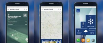
Our review would not be complete without the Yandex.Maps application (Android, iOS), which absorbed the popular Yandex.Transport application last 2022. Like other applications of this type, it allows you to select the desired locations, build a path and track public transport in your city on the map. The movements of buses, trams and minibuses are displayed in real time.
Tapping on the desired stop in this application will standardly show when the next buses will arrive at it, and where my transport is located.
OneBusAway
OneBusAway is an open-source application that allows you to mark the desired stops and search for the nearest ones, set reminders for frequently used routes. As the name of the app suggests, it only focuses on buses.
Unfortunately, OneBusAway, unlike the apps described above, does not attempt to cover all types of public transport. The application specializes only in buses and operates in a limited area: Oregon, California, Washington (state), Florida, Washington (DC), York Province in Canada.
Launch OneBusAway, look at the map of the city you need - each green dot represents a bus stop. Tap on a stop and get detailed information on bus routes passing through it.
Available for Android/iPhone.
What are the features of bus tracking applications?
Nowadays there are a sufficient number of mobile applications on the market that allow you to track the location of public transport in most Russian (and not only) cities. Such applications usually work under a contract with local municipalities, which provide the application with access to the local public transport tracking system.
Typically, such applications are good at tracking local municipal vehicles (owned by local authorities). With private carriers (so-called minibuses), tracking works at an average level. This is due to the fact that GPS navigators installed on private buses are forced to be installed and maintained by private owners at their own expense. Since private entrepreneurs are not interested in unnecessary expenses, as well as in their close monitoring by third parties, they try to avoid working with trackers. Therefore, you simply will not see many of the private buses using the mobile applications we have listed.
Many of the applications we list below are international and cross-platform in nature. This means that you will find versions of such applications for Android and iOS, as well as for Windows OS. They will work perfectly both in Yekaterinburg and in Milan and Paris.
Below we will look at which applications can show exactly when the bus will arrive at the desired stop.
Google Maps
Sometimes you need to go back to basics. If you're already familiar with Google Maps, then you probably know how easy it is to work with this application. Just enter your destination and the service will immediately select the best route.
If you are interested in public transport, click the train icon at the top of the menu. At the same time, the service will provide information not only on railway transportation, but also on bus routes, as well as on the schedule of trams and metro trains.
Available for Android/iPhone.
Common Mistakes
There are several factors that can degrade system performance. All of them are listed in the table.
| Problem | Description |
| Incorrect installation of the beacon | The tracker must be installed with the internal antenna facing up. If the device is covered with metal parts or tinted glass, the device will not work. |
| Weather | Heavy clouds, magnetic storms, and hurricanes can distort the signal. The increase in error is associated with weather changes. |
| Physical barriers to the signal | Concrete walls, multi-story buildings, and even dense foliage in the forest can interfere. The signal also disappears when moving underground. |
| Sources of third-party interference | If the tracker is located near large electrical appliances, their operation may interfere with signal reception |
| Outdated almanac | If the beacon came from another country, then it could “remember” the position of the satellites in the sky above its homeland. As a result, after moving, the device will look for satellites where they obviously cannot be. |
Navigation programs have come a long way since their invention. Many of them are created for a special application: tracking the route of an airplane or train online. Thus, the Russian Railways service allows you to track long-distance trains, but electric trains, or, for example, the Sputnik high-speed train, cannot be seen.
However, most of the developments serve people in their daily lives, in particular, it helps to carry out GPS monitoring of vehicles.
