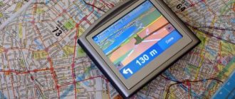
An indispensable companion on any journey is a high-quality navigator. And not a separate device, as before, but a trusty iPhone or iPad with navigation software installed. Our selection today is dedicated to navigators that will help you avoid getting lost, chart a route, and find a way out of any dead end. Here are 8 great navigation apps.
Let us immediately draw your attention to the fact that the selection deliberately did not include the mapping services of Apple and Google. In addition, all navigators are located in random order and are in absolutely equal conditions. You can share your preferences in the comments after reading. Go!
Navitel
Developer/Publisher : Navitel Version : 9.4.0.84
Let's start our tour of navigators for iOS with Navitel . The application has been on the App Store for a very long time and offers very high-quality navigation. Maps in the application are available on a subscription basis for many regions, including not only Russia and the CIS countries, but also Europe. They are updated frequently and contain a comprehensive number of POIs (points of interest). The main drawback of Navitel persists throughout many versions - it is a frankly unsuccessful interface. The application not only looks alien within iOS, but also makes navigation difficult due to the confusing organization of the interface. Otherwise, Navitel has everything necessary to perform its functions efficiently and is unpretentious to the presence of the Network.
iPhone + iPad : Free (+ maps purchased in app) []
Alternative navigation methods (other than GPS)
Smartphone owners sometimes have the opportunity to use alternative navigation methods. Firstly, it is worth mentioning GPS analogues in the form of GLONASS, BeiDou and Galileo. These are satellites of the Russian Federation, China and the EU, which are designed to determine the location of users. Modules that can communicate with these satellites are installed in a number of smartphones. Unfortunately, the iPhone does not have the corresponding chips, so you need to be content with GPS.
Secondly, there is another way to navigate not using GPS - using base stations of mobile operators. Its essence is that the phone receives information about the signal strength of different GSM transmitters, and based on this it makes location calculations relative to them. The closer the results are to reality, the better the location can be determined. This method is practiced by some Android users. There are attempts to replicate this on the iPhone, but this is only available to those who have jailbroken their iPhone, and the quality of navigation suffers due to the experimental nature of the applications and poor development.
The last way to determine location is using Wi-Fi networks. It is relevant only for the megacities of some countries, where there are Wi-Fi points at almost every step. The pre-downloaded map contains the names of each Wi-Fi access point, and the phone draws a conclusion about the location based on which networks are in the signal reception area. This method is convenient, but it is not very developed on iPhones. However, the opportunity to take advantage of it exists.
Video - Just about how GPS works
Yandex.Navigator
Developer/Publisher : Yandex LLC Version : 1.60
Next up is Yandex.Navigator . In the conditions of your hometown and a constant connection to the Internet, this is an excellent solution for navigation. High-quality Yandex maps cover many cities, clearly reflect the traffic situation and various events, receiving them from other drivers in real time. Yandex.Navigator also has voice control, as well as the ability to load maps into the device’s memory. Unfortunately, there are also a lot of unpleasant moments. The application will not warn you about speeding; multi-lane and dirt roads can also create problems for the navigator. Finally, the application is still focused specifically on a constant connection to the Internet, otherwise you will have to make too many compromises. But Yandex.Navigator is absolutely free.
iPhone + iPad : Free []
ViaMichelin
For those traveling to Europe and planning to rent a car, I recommend installing the free ViaMichelin app on your iPhone. This program is very common in European countries, and its popularity can be compared with our Yandex.Navigator. By the way, it also works in Russia, but the cards leave much to be desired.
With a consumption of 6-7 liters per 100 km, the information is very close to reality.
If you come to Europe and suddenly need to go somewhere by car, but you don’t have a navigator, then here is a very useful link:
m.viamichelin.com
This lifesaver link has helped me more than once in Italy, Spain, and France. There is no need to install the application, just open the web version of the navigator in your browser. Of course, this is not a turn-to-turn, but it will help out in difficult times. And strangely enough, WebApp has more functionality than an application. This version has added speed measurement posts, which will greatly help fans of fast driving.
PROTOWN
Developer/Publisher : NFB Investment Version : 2.0.3295
PROGOROD is a worthy solution for navigation in Russia, the CIS countries and Europe. At the same time, to obtain unlimited access to cards you will need to pay once for a full license. The navigator regularly warns of various road objects, including speed limits and speed bumps. Driving around the city with this application is really convenient, and voice control allows you to pay less attention to the terrible interface. If you are willing to put up with it, you will get one of the best navigators in terms of building routes and guiding on the road. Good, but not perfect.
iPhone + iPad : Free (RUB 1,390) []
Bottom line
Where did I end up? It turned out that it was impossible to find one application for all tasks, so I had to leave several: - these are, of course, standard Apple maps, which soon (I really hope) will work adequately in Russia. Left only because they cannot be removed. - 2 GIS. As a useful source of information about the city, in which it is very convenient to search for the necessary addresses/telephone numbers/locations. – Yandex.Navigator. As the main system for navigation. In conjunction with user tips, this is quite a good solution. - PRO-City. I am currently actively testing it before deciding to purchase. The license is not cheap (about 1,200 rubles), so it is better to identify all the “jambs” in advance, especially since for the first 30 days the application can be used absolutely without restrictions. And if this time is not enough, then for “like” on Facebook or VKontakte you will be given the same amount of time to continue testing. Perhaps, if I decide, it will take the place of the navigator from Yandex. For now, that's it.
Of course, there are other navigation systems, but nothing else came into view. Maybe you can tell me if you yourself use similar applications, and if so, which ones?
NAVIGON Russia
Developer/Publisher : Garmin Version : 2.9
NAVIGON is the same good old Garmin in a new way. The application has perfect maps, excellent navigation characteristics and stands as a full-fledged standalone navigator. The Russian map alone will cost you 5,290 rubles, but the program also has in-app purchases through which you can access additional functions. Otherwise, this is exactly the navigator that experienced drivers are accustomed to. Expensive, but very high quality. Perhaps the best solution for Europe. However, for Garmin there are still blank spots on the map, for example, in Belarus. By the way, NAVIGON, for its price, can be used as a pedestrian navigator and work without connecting to the Internet.
iPhone + iPad : 5290 rub. []
Using the Maps service
Now it’s clear how to enable GPS on iPhone 5s. Next we will talk about how to work with this service. For example, about setting up location detection in the Maps program.
To bring your idea to life, you will need:
- Go to the iPhone main menu. To do this, click on the “Home” button.
- Find the Maps application on the screen. Click on the corresponding icon.
- Click on the folded map screen. A menu with settings will appear.
- If you press the “Satellite” button, a map image from the satellite will pop up on the display. The blue pointer is the subscriber's position.
- Select "Hybrid". This function overlays street names and house numbers on satellite images.
- If you click on the arrow button in the lower left corner, a compass will appear. The orange “nose” points north.
- How to set up GPS on iPhone 5s? Please note that when using the Maps application, the map is rotated in the direction your mobile device is pointing.
That's all you need to know about working with Maps. The main thing is to turn on the Internet and geolocation services. After this, the GPS navigator will work without any problems.
CityGuide
Developer/Publisher : MIT Geomatics Version : 8.2.081
CityGuide is one of the fastest applications among those discussed in this collection. It loads quickly and works quickly, supports OSM (OpenStreetMap) maps, which can replace paid analogues available for purchase from the application. In addition, for 4,290 rubles you can install HERE from Nokia in your navigator. In general, CityGuide is a decent solution that works great without an Internet connection, but with one, the application can reveal itself even better. By the way, the interface is somewhat reminiscent of Navitel and is also far from an acceptable level of comfort. For some reason, developers focus on external navigators when creating an interface rather than on the accepted standards of mobile operating systems.
iPhone + iPad : Free (maps purchased in app) []
Google Maps – a walking navigator with support for offline maps
Google Maps is one of the best free navigators that fully supports creating walking routes. A great assistant for tourists who need to create a travel route for offline use.
A short instruction for Android on how to create routes for pedestrians in the Google Maps application (the Internet must be turned on):
- Specify your destination on the map (by clicking on it) – the “Route” button.
- “Go” button – Icon with a picture of a person.
- My location is “Where”.
- Instead of “Where”, if necessary, set the destination point.
Google Maps application as a walking navigator (route building)
Google Maps will select the optimal walking route, taking into account the terrain you need to follow. If several options are available, you can accordingly choose the one that suits you best. Additionally, the distance, time to travel, in steps and with turns will be indicated.
The application developers note: the pedestrian mode is in the testing stage, so there may be inaccuracies and errors. However, for a pedestrian this is not critical, as when driving a car quickly, when the application must quickly respond to road events.
A nice bonus for users of the mobile version (Android/iOS) - Google Maps also works offline. This is a useful and often indispensable feature for hiking and hiking.
You can download a map and travel to different countries without worrying about an Internet connection. However, it will not be possible to build a walking route without the Internet; you will have to navigate only by coordinates - marks that are synchronized by GPS.
| Advantages | Flaws |
|
|
Download navigator: Android | iOS
CoPilot
Developer/Publisher : ALK Technologies Version : 9.6.2.812
CoPilot can be downloaded for free and then expanded with features and maps through in-app purchases, or you can immediately pay a tidy sum for the navigator. The application works great without access to the Internet; maps are always downloaded to the device in their entirety. The database contains many POIs, searchable via Google and Wikipedia. The main drawback of the program concerns the cards themselves. They are exclusively two-dimensional and look outdated compared to competitors, although their relevance is not in doubt. The navigator also has a convenient pedestrian mode.
iPhone + iPad : Free (maps purchased in app) []
What is GPS
Global Positioning System or simply GPS is a positioning system that is designed to determine the location of objects, both moving and stationary. GPS is based on receiving/transmitting information to communication satellites, which send the exact coordinates of an object by position on the network. This technology has long been used in many mobile devices and simplifies the tasks of orientation and coordination in space.
All modern smartphones have built-in GPS receivers, so one of their features is constant geolocation. On Apple devices, this technology is implemented in a geolocation complex. The built-in GPS module is responsible for orienting the device in space. The transmission speed of geodata and the accuracy of determining coordinates is improving with each new smartphone model.
The signal from the devices is picked up by satellites, from which data is transmitted to the station
MAPS.ME
Developer/Publisher : MY COM Version : 4.2
MAPS.ME differs significantly from the classic navigation programs that we discussed above, but this does not mean that they are worse. It's just a different kind of application. These are full-fledged offline maps based on OSM. The maps are highly detailed, the number of POIs is off the charts, a convenient search is implemented, access to the Internet is not required at all, and the application is free. Perhaps the only thing missing is the ability to plot walking routes, and there are also errors on the maps that can easily be attributed to OSM costs. We also note that the navigation capabilities behind the wheel are somewhat inferior to competitors, but from the point of view of offline operation, MAPS.ME still remains unrivaled among free products. By the way, I would also like to improve the interface.
iPhone + iPad : Free []
Waze for iPhone - the best navigator for Ukraine
After the “death” of Yandex in Ukraine, many drivers were faced with the question of choosing a worthy alternative with the same detailed maps and a reliable navigator that would definitely lead to the right address. Waze turned out to be such a service. In many ways, it took the best from its parent Google Maps, but here there is live communication between users - weizers. A kind of social network of people using a navigator. The map shows the nearest wasers; you can “say hi” to them. But the other main thing is up-to-date information from living people, about where the patrol police hid in ambush, where the accident occurred, where repair work is going on, where the traffic jams and congestion are, and what the speed of traffic is on the main streets of the city. It even warns you where there are potholes. This is the best for our dull Ukrainian roads.
Waze always guides you correctly and supports CarPlay
For a taxi driver, for whom it is important that the navigator automatically selects the best and fastest option to take the client from point A to point B, this is an indispensable and best mapping service. The only slight drawback is the not entirely correct pronunciation of street names by the voice assistant, especially in Ukrainian, but you can get used to this and not pay attention, and sometimes even cheer yourself up while driving.
Install Waze
2 GIS
Developer/Publisher : LLC DoubleGIS Version : 3.19.3
Our selection today is completed by the 2GIS , which also has a very conditional relationship to navigation. Rather, it is an excellent directory of addresses and facilities located in your city. Moreover, the application works not only without an Internet connection, but even without GPS. However, it can provide route directions and show detailed 3D maps, which even show the number of floors for buildings. In general, 2GIS should be considered as a good collection of POIs with minimal navigation capabilities. However, this will be enough to search for a specific address or organization.
iPhone + iPad : Free []
( 15 votes, overall rating: 4.13 out of 5)