All modern Android smartphones are equipped with a GPS module, which supports communication with satellites regardless of the presence of a cellular network. Offline maps operate on approximately the same principle - they are saved in the phone’s memory, so you can access them absolutely at any time.
However, not all navigation applications perform their functions properly in offline mode. We studied the topic and compiled the top 7 best navigators without the Internet for Android. Most of the programs on the list are free, so you'll have plenty to choose from.
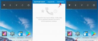
Yandex.Navigator
Trying to find a good road map for Russia or Ukraine can be quite difficult. Fortunately, Yandex has released its navigator. It can calculate the shortest route, show traffic jams and accidents on the road. In order not to be distracted from driving, you can give voice commands. All you have to do is say “Hey, Yandex” and tell the navigator what you need to do, for example, build a route from your current location to the nearest gas station. A choice of three best routes will be shown, including the shortest one.
You can download maps for offline use, enable 3D mode, receive important notifications, and use automatic zoom. The navigator can automatically switch between day and night mode, or you can set it manually. Setting your destination can be done by simply touching or using the search function. You can also use the search to find a variety of establishments: from ATMs to bathhouses. If there is a toll road, it will be marked with the corresponding icon.
Available for Android and iPhone.
Which phone navigator is better, what to choose
It is difficult to give an unambiguous answer to this question. You should choose based on your own needs. If you find it difficult to make a choice, use the tips below:
- If there is no constant connection to the Internet, the navigator must have good battery life.
- Maps from Russian developers, as a rule, have better detail.
- More popular apps have a large community, which improves the interactivity of traffic incident maps.
- Some programs come with unique features.
Maps.me
Maps.me provides map downloads for offline use, turn-by-turn navigation, and map updates via OpenStreetMap. The functionality allows you to make bookmarks, perform offline searches, and receive up-to-date information about road traffic (when this information is available). The application is completely free, there are no paid updates. Advertisements are shown, but this does not cause any inconvenience.
The database of places that may be of interest is impressive: restaurants, shopping centers, free Wi-Fi zones, public toilets. Please note that you will not receive up-to-date traffic information in real time. The application is designed for offline navigation when there is no Internet. You get full support for navigation across 345 countries, as well as the ability to share your location with your loved ones.
In offline mode, the following are available: full-function search, voice navigation, alternative routes, information about public transport. If you have Internet access, you can even book a hotel room directly from the application.
When you first launch Maps.me, it will not ask which region you want to download a map of. Instead, the download automatically starts for the current location. Navigation options include traveling by car, motorcycle or bicycle, public transport, taxi or on foot.
Available for Android and iPhone.
Sygic
Sygic is a very popular navigation app. To date, it has already been downloaded by more than 50 million users. As with the other apps on our list, Sygic allows you to download maps for offline use, as long as you don't use commercial TomTom maps.
The functionality is standard, it has everything you might need: full navigation (autonomous, turn-by-turn, voice), alternative routes, attractions from TripAdvisor, parking tips, warnings about speed limits on the road. It is worth noting the free update and navigation for pedestrians.
If you have an Internet connection, Sygic will tell you where to find cheap parking or gas stations, and will give you access to road safety cameras. Each map is updated several times a year, so the information will always be up to date. There is a paid add-on that projects the navigation screen onto the car's windshield.
You will have to pay for all additional functionality. The developer offers three paid premium versions. For $14 you get slightly expanded basic functionality. The $20 version offers traffic and traffic updates. For $30 you will be able to use all the functions provided by the developers.
Not cheap, but this is a fee for the entire time you use the application, and not a subscription for a month or a year. The paid version can be tested for free for a week from the moment of downloading.
Available for Android and iPhone.
Comparison of 5 popular navigation apps for Android
Here is the final part of the “series” about popular car navigation applications for Android. In it, we tried to summarize all the information from five previously published reviews of individual applications and give a final assessment. In order not to burden the reader, we will try to do this in the most concise and clear form using tables, providing them with relatively small comments.
Here is a list of participants with links to detailed reviews:
- CityGuide 7.8 SP2 (7.8.352)
- Sygic 13.4.1
- Navitel Navigator 8.5 (8.5.0.1191)
- Yandex.Navigator 1.51
- Progorod 2.0 (2.0.3257)
Why did you choose these particular applications? The main criteria were popularity and the presence of a large number of positive reviews, as well as ease of use. The updated Shturmann did not fit into the first two criteria a little. The “Seven Roads” application did not pass all three criteria. Google Maps as a navigator is still in beta testing. Megafon navigation is essentially the same as Progorod, but only in an online version. The iGO app has not yet officially appeared in the Android version. Therefore, there are only five participants.
Prices and popularity
Putting ourselves in the buyer’s shoes, let’s start by looking at price tags and studying information about how popular a particular product has gained among users.
| Navitel | Progorod | Sygic | CityGuide | Yandex | |
| number of downloads on Google Play, million | 5-10 | 0,1-0,5 | 10-50 | 1-5 | 5-10 |
| rating on Google Play | 4,1 | 4,2 | 4,2 | 4,1 | 4,2 |
| price of Russian cards | 1350 rub. | 1290 (950*) rub. | €40 | 1800 rub. | for free |
| minimum price | $1** | — | €20 | 990 rub. | for free |
| update fee, rub | for free | for free | for free | for free | for free |
| traffic jam service fee, rub | for free | for free | does not work in Russia*** | for free | for free |
| allowed number of reinstallations | 1 | 3 | n.d. | 3 | not limited |
| free third party maps | Yes | Yes | No | Yes | No |
| test period, days | 30 | 30 | 7 | 15 | — |
* if you purchase a key on the developer’s website. The price is for the application itself with unlimited access to maps. ** rental of foreign cards. *** for Europe the service is paid - from 12 euros per year.
So, the most expensive product is Sygic. It is aimed at European consumers, so the price tag is quite appropriate. In addition, you will have to pay separately for traffic jams and advanced information about cameras, but this all applies only to Europe. Network services do not work in Russia.
The prices of Navitel and Progorod seem to be the most adequate. However, Navitel has a very strict policy regarding reinstallation. Transferring the application to another smartphone will most likely not work at all.
Against the backdrop of all these restrictions, Yandex looks like a king. However, the application has a number of significant limitations, thereby leaving good chances for others.
Feature Set Comparison
The developers of most of the presented applications are trying to attract users with various additional functions, for example, weather, photos on a map, articles from encyclopedias, tagging in social networks, displaying the location of friends and even augmented reality.
We have summarized the entire core set of functions of all five applications in one table:
| Navitel | Progorod | Sygic | CityGuide | Yandex | |
| Interface | |||||
| Manual map zoom during navigation | Yes | Yes | Yes | Yes | Yes |
| Battery/satellite/GSM indicators | Yes Yes Yes | yes / yes / no | in the menu / in the menu / not | Yes Yes Yes | OS status bar |
| Changing the map orientation | Yes | Yes | Yes | Yes | Yes |
| Manual map rotation | Yes | Yes | No | No | Yes |
| Mileage information | Yes | Yes | Yes | Yes | No |
| Satellite View Screen | Yes | Yes | No | No | No |
| 3D mode | Yes | Yes | Yes | Yes | Yes |
| Map tilt | only in 3D | Yes | Yes | Yes | Yes |
| Quick Access Toolbar | DPOI only | Yes | Yes | Yes | DPOI only |
| "Trip computer" | Yes | No | Yes | Yes | No |
| Night mode | Yes | Yes | Yes | Yes | Yes |
| Augmented Reality | No | Yes | No | No | No |
| Search | |||||
| Universal | No | No | Yes | No | Yes |
| Address | Yes | Yes | Yes | Yes | No |
| By coordinates | Yes | Yes | Yes | Yes | No |
| POI around / at the point / at the finish | Yes Yes Yes | Yes Yes Yes | Yes Yes Yes | Yes Yes Yes | Yes Yes Yes |
| Voice input | No | No | No | No | Yes |
| Working with routes | |||||
| Save/Load | Yes | Yes | Yes | Yes | No |
| Simulation of driving along the route | Yes | Yes | Yes | Yes | No |
| Full display | Yes | Yes | Yes | Yes | Yes |
| Working with tracks | Yes | Yes | No | Yes | No |
| Operating modes: passenger car / truck / pedestrian | Yes Yes Yes | yes / no / no | yes / no / yes | yes / no / yes | yes / no / no |
| Cards | |||||
| Map update | Yes | Yes | Yes | Yes | Yes |
| Provider | n.d. | own | Navteq | many, different | Navteq, Scanex, etc. |
| Installing third-party and free maps | Yes | yes, based on OSM | No | yes, based on OSM | No |
| Online services | |||||
| Traffic display | Yes | Yes | No* | Yes | Yes |
| Dynamic POIs | Yes | Yes | Yes | Yes | Yes |
| Friends on the map | Yes | No | Yes | Yes | No |
| Thematic news feeds | No | No | No | Yes | No |
| Photo on the map | No | No | yes (Panoramio) | No | No |
| Weather | Yes | No | No | No | No |
| Ban on Internet access | Yes | by disabling the traffic jam service | No | Yes | No |
* only for European countries for a fee
This table is intended for self-study. Here everyone must answer the question for themselves whether this or that program has a minimum sufficient set of functions. For example, some people definitely need to work with tracks, while others need to install free OSM maps. Some applications also have extraordinary abilities. For example, displaying on a map photos of places taken by Panoramio users (from Sygic), or an augmented reality mode (Progorod), as well as speech recognition and voice commands (Yandex.Navigator).
The applications also have major flaws. Thus, Sygic does not have a function for displaying traffic (traffic jams), and Yandex.Navigator will not work fully in the absence of an Internet connection.
Interface
Since each of us has our own ideas about beauty, we will not talk much about which program’s interface is more beautiful. Our eyes found the “picture” of Navitel Navigator, Progorod and Yandex more pleasant. But this does not mean that the other two programs have any problems with their “appearance”. They're all good. These just stand out a little from the general background.
But if you step back from looking at the “pictures,” then completely different properties of interfaces come to the fore—practicality and information content. The first of them is when you always feel at ease. All you need is a quick glance at the screen to get as much information as you need. A not very good example of practicality is the interface of the same Navitel - a jumble of thin lines and small details makes it difficult to read information while driving. Practicality also includes ease of operation with menus and search.
By information content we mean displaying various related information on the screen, such as the speed limit in a given area, information about cameras, etc. Availability of all kinds of hints and additional information in the POI database.
So, below we will provide screenshots of the interfaces of all programs with a short list of the main advantages and disadvantages. This time we will use a smartphone with a small screen resolution of 480x800, which is regulated by almost all software developers in today's test.
Let's start with the vertical map display option, which is the most natural for smartphones and more practical for navigation. Next to the usual map view we will place a 3D version.
Navitel Navigator 8.5
Progorod 2.0
Sygic 13.4
CityGuide 7.8
Yandex.Navigator 1.5
This is the junction of the Warsaw Highway and the Moscow Ring Road. Alas, the picture is static, and its perception while moving, when the scale of the map is constantly changing depending on the speed and upcoming events (turns), is radically different from what you will get simply by contemplating these two sets of screenshots. In addition, in 3D mode a lot depends on the tilt angle, which is adjustable in all programs. The developers have made it so that from one angle the map is beautiful and practical, but from another it is inconvenient to use, because the detail, perspective, etc. change. A similar remark can be made about scale. Therefore, we will give a verbal comment, but first we will post another portion of screenshots taken in navigation mode:
Navitel Navigator 8.5
Progorod 2.0
Sygic 13.4
CityGuide 7.8
Yandex.Navigator 1.5
Navitel Navigator
The picture deserves all the praise, but it is extremely impractical. The accumulation of a mass of small lines and contours makes it difficult to perceive the route line on the screen, which is slightly thicker than the road itself, but with busy traffic jams is in no way different from it in color. Camera icons, signs and other details are barely visible on the screen.
Progorod
The “Picture” is a little similar to Navitel, but there are fewer small details, and the route line is much easier to read than in the previous case. There are two complaints: the status panel takes up a lot of space on the screen and chaos reigns on it, as well as the graphics and all the control buttons are too small.
Sygic
In the screenshots, the interface is unimpressive, but from the point of view of ease of reading information while driving, it deserves the highest rating. There is one significant drawback - house numbers are not displayed in navigation mode. They only appear if you try to scroll the map in one of the directions, which will switch it to viewing mode.
CityGuide
The map interface is quite good in practical terms. It may not be as beautiful, but it is quite comfortable.
Yandex.Navigator
Trying to find fault with the Yandex.Navigator interface did not work out well. He is very practical. The only issue is that users of platforms with screens with a high pixel density per inch complain about small buttons and other elements in the menu. For some reason, these UI elements did not fully comply with Google's developer guidelines, and programmers were working with absolute units of element sizes instead of relative DP and SP.
Well, for those who for some reason prefer the horizontal position of the map, we will post another set of screenshots.
Navitel Navigator 8.5
Progorod 2.0
Sygic 13.4
CityGuide 7.8
Yandex.Navigator 1.5
Cards
Unfortunately, most developers do not provide detailed information about their cards, since they may not look so brilliant compared to competitors.
We tried to collect as much information as possible and summarize it in one table. Pay attention to the line “Map online” - this is your chance to independently evaluate the quality of coverage. True, it also does not entirely accurately reflect the situation. Navitel and Progorod do not have the latest release online, while Yandex’s maps in the app and online are strikingly different in places, which sometimes causes confusion.
| Navitel | Progorod | Sygic | Cityguide | Yandex | |
| Russia: populated areas | 149 047 | n.d. | n.d. | n.d. | ≈170 thousand |
| Russia: cities with details | 8762 | n.d. | n.d. | n.d. | n.d. |
| Road graph, km | 3 809 652 | n.d. | n.d. | n.d. | n.d. |
| POI objects | 992 163 | n.d. | n.d.* | n.d. | n.d. |
| Card capacity, MB | 1250 | 1131 | 623 | 1900 | 1910** (Moscow only) |
| date of last update | 25.10.2013 | 22.10.2013 | 12.2013 | 22.01.2014 | n.d. |
| Update frequency per year, times | 3-4 | 2 | 1-3 | 2-10*** | n.d. |
| Map online | navitel.ru/map | pro-gorod.ru/maps | — | — | maps.yandex.ru |
| Maps of foreign countries, pcs. | 52 | 28 (OSM) | ≈130 | 10 | 1**** |
| Information about maps on the developer's website | navitel.ru/coverage | pro-gorod.ru | — | probki.net | — |
* data from Foursquare is also used as POI objects ** the volume of the full map of Moscow is indicated *** the map of Russia is updated almost every month, but changes in it each time concern a couple of separate areas. If we take, for example, the map of Moscow, it is updated twice a year. ****Ukraine, Belarus and Türkiye are mentioned on the application page. There is no longer a word about Turkey in the company video, and only Ukraine appears on Google Play. However, in the list of maps for download you can find, for example, a map of Almaty.
According to the results of the 2010 census, the number of settlements in Russia was just over 153 thousand and about 20 thousand of them do not have a permanent population. Where did Yandex get 170 thousand from then? Firstly, nesting. A specific settlement always belongs to other territorial units. Secondly, the census does not take into account all types of settlements. Railway stations, winter huts, etc. may fall out of it.
So, our leaders, apparently, are Navitel and Yandex. The volume of cards is an indirect indicator. In Yandex.Navigator it has such unimaginable values because these maps contain a huge number of raster images.
As for the details, this issue is complex and requires a lot of time to study. For our own understanding, we took several settlements and looked at how things stand with this issue.
| Navitel | Progorod | Sygic | Cityguide | Yandex | |
| Olenegorsk, Murmansk region | detailed, with houses (3D) | three main streets | only the main street, with errors | detailed, with houses | three main streets |
| Bogoroditsk, Tula region | detailed, with houses | detailed, with houses (3D) | only the main street | detailed, with houses | three main streets |
| Angarsk, Irkutsk region | main road network | detailed road network | only the main street | detailed, with houses | detailed, with houses |
| Petropavlovsk-Kamchatsky | detailed, with houses | detailed road network | only the main street | point on the route | detailed, with houses |
| Astrakhan | detailed, with houses | detailed, with houses (3D) | detailed, with houses | detailed, with houses | detailed, with houses |
| Sochi | detailed, with houses | detailed, with houses (3D) | detailed road network | detailed, with houses | detailed, with houses |
| Chekhov, Moscow region | detailed, with houses | detailed, with houses (3D) | detailed, with houses | detailed, with houses | detailed, with houses |
| Tver | detailed, with houses | detailed, with houses (3D) | detailed, with houses | detailed, with houses | detailed, with houses |
| Rybinsk | detailed, with houses | detailed, with houses (3D) | detailed, with houses | detailed, with houses | detailed, with houses |
| Pechory, Pskov region. | detailed, with houses | main road network | three main streets, with errors | detailed, with outlines of houses, without addresses | three main streets |
| village Lanshino, Moscow region | part of the road network | a point on the map | detailed road network | detailed road network | main road network |
The leaders were Navitel, Progorod and Cityguide. Moreover, the maps of Progorod in almost all settlements from the table have buildings not only with corresponding contours, but also with height. Although CityGuide is good (OSM maps are used), you will have to search for maps of the regions you need in a large list and download them separately, which is not very convenient. For some reason, you can’t download the entire map of Russia at once. In addition, the Kamchatka Territory was not on the list.
Yandex.Navigator surprised me a little, and this considering the fact that the online browser map is beyond praise. At the same time, it is very funny that in the same Bogoroditsk you can indicate the exact address, it will be marked with a marker on the map and a route to it will be built. But the "last mile" will not be displayed correctly.
Well, Sygic doesn’t like small towns the most. He knows them only by hearsay.
The issue of map relevance is also important. Here we were guided by the map of Moscow, noting the presence of new well-known roads, overpasses and interchanges, opened in the summer-autumn period of 2013. Progorod, Cityguide and Yandex had no problems with this. Navitel had all the junctions and overpasses we were looking for, but for some reason at the intersection of Yaroslavskoe Highway and Malyginsky Proezd there was no turnaround under the overpass. But Sygic's map is at least a year old. We did not find any of the required road objects on it.
Our choice of maps : Navitel, Progorod and Cityguide.
Routes and navigation
All applications build quite adequate routes. And this is the most important thing. Navitel has some minor glitches. We described one of them in its detailed review, but there is no reason to panic here. But it’s definitely worth reducing the sensitivity to traffic jams in its settings for residents of megacities.
To save the reader time, we will collect information on routes and navigation into one table.
| Navitel | Progorod | Sygic | Cityguide | Yandex | |
| adequacy of constructed routes | OK | OK | OK | OK | OK |
| number of alternatives | No | 2 | 1 | No | 1-2 |
| exclusion of toll roads / other settings | Yes Yes | Yes Yes | Yes Yes | Yes Yes | no no |
| logic of behavior when leaving the route | customizable | changing lanes in detour mode | return to old route | changing lanes in detour mode | changing lanes in detour mode |
| traffic jams on the route | Yes | Yes | No | yes, but at a short distance | Yes |
| speed warnings | Yes | Yes | Yes | Yes | No |
| camera warnings | Yes | Yes | Yes | Yes | yes, late |
| DPOI | Yes | Yes | No | Yes | Yes |
| work without an Internet connection | Yes | Yes | offline only | Yes | functions are very limited |
It will be most convenient to travel with Progorod, Cityguide and Navitel. Sygic, despite its very practical interface, works only in offline mode: no traffic jams or DPOI. In addition, his logic of behavior when the driver leaves the route is far from civilized. But there are no less problems with Yandex: it will not warn you about speeding, it will only tell you about the camera when you drive past it, and without a connection to the Internet, search and route planning will not work in the application! But before starting navigation, it will offer the user alternative route options, which can be viewed on the map and the most suitable one can be selected. Progorod can do this too, although it uses a slightly different logic. We really liked both of these features.
Our choice : Progorod and CityGuide. With some stretch - Navitel and Yandex.
Tests
We've run a series of tests to show how fast these apps will run on different mobile platforms. In a separate table we have summarized the results obtained on two systems, the main characteristics of which are as follows:
| smartphone Zopo ZP100 | Tablet Prestigio Multipad 4 Ultimate 8.0 3G | |
| Screen | 4,3″, 960×540 | 8″, 1024×768 |
| SoC | MediaTek MT6575 @1 GHz, 1 Cortex-A9 core | MediaTek MT8389 @1.2 GHz, 4 Cortex-A7 cores |
| Graphic arts | PowerVR SGX531 | PowerVR SGX544MP |
| RAM | 512 MB | 1 GB |
| Flash memory | 4 GB | 16 GB |
| Battery | 1650 mAh | 4850 mAh |
| operating system | Android 4.0.3 | Android 4.2.1 |
| Average retail price | T-9292625 | T-10515622 |
Both platforms are budget, but the tablet has a 4-core SoC, while the smartphone has a single-core SoC, but with a more modern architecture. Will there be any significant difference between them? In the table, smartphone and tablet data are separated by two vertical bars.
| Navitel | Progorod | Sygic | Cityguide | Yandex | |
| Loading time, s | 11 || 8 | 5-6 on both platforms | 6 || 3 | 12 || 9 | ≈2 in all cases |
| Satellite search time | in accordance with GPS technologies (1-2 min.) | ≈20-30 sec.** on both platforms | |||
| Route planning time, s* | 2,5-5 || 1,5-5 | 1-4 on both platforms | 12-20 || 6-15 | ≈2 in all cases | -*** |
| Utilization of computing cores in motion, % | 60 || n.d. | 70 || n.d. | 40 || 15 | 65 || 19 | 20 || n.d. |
| Smooth scrolling and zooming with traffic jams disabled | with strong jerks | with jerks | relatively smoothly | relatively smoothly | smoothly |
| Volume of network traffic on the route, MB/h | 2,5 | n.d. | — | n.d. | n.d. - 4**** |
| Volume of network traffic in a metropolis, MB/h | 4,5 | 1 | — | 1 | 3,5-6,5**** |
* the dash indicates the time of laying two routes: from the south of Moscow to the city of Olenegorsk in the Murmansk region; the second route is to Vladivostok. ** already two seconds after loading you see your approximate position on the map, determined by signals from base stations and their coordinates. And after another 20-30 seconds the device “clings” to the satellites. ***routes are calculated on a remote server, and construction time depends on the quality of communication at a particular time. In the coverage area of GPRS or EDGE it may take a minute or more, but with a good connection - 2-3 seconds. **** The first digit indicates the traffic volume in the case of a pre-loaded full map of the region. The second digit indicates when the card cache is empty.
So, the main problem with application performance is the inability to use all available computing cores of the SoC. And although multithreading is declared by almost all developers, in practice on a 4-core system this results in one core being loaded at 100%, the second at 30%, and the other two cooling down. The only exception is Yandex. The application not only has low requirements for system resources, but also, when actively running on four cores, can show a total load of 60-70%, which indicates that someone is still able to create multi-threaded applications (benchmark developers are not check).
If we talk about the smoothness and comfort of working with the map, then Yandex, Cityguide and Sygic behave quite well, which cannot be said about Navitel and Progorod. Scrolling the map and scaling occurs with noticeable jerks, slowdowns and jerks. Moreover, if your smartphone has a resolution of 1280 pixels or more, the situation will worsen regardless of the type of SoC installed in the system.
Our choice : Yandex, CityGuide and, probably, Sygic. The latter takes a very long time to build routes, but otherwise is very smart.
Application Features
Since the competition is great, developers try to add a few highlights to their creation, and it would be a shame not to mention them.
Navitel Navigator
Two things we liked were that maps rented for as little as a dollar for a couple of weeks, and the weather forecast was displayed right on the map. Details in the detailed review.
Progorod
Here we will only note the augmented reality mode, which will work quite well on those devices that have an orientation sensor.
Perhaps it will come in handy when traveling by car.
Sygic
Sygic tries to attract users with all sorts of useful and interesting little things: universal search, photos on the map from Panoramio, POIs from Foursquare, articles from Wikipedia (if they have a link to coordinates), a sidebar and a trip computer. All details in the corresponding review.
CityGuide
Nothing unusual.
Yandex.Navigator
The main advantage is a universal search with a speech recognition system and voice commands, which works quite well.
Results
So, the most mentions marked “our choice” went to CityGuide and Progorod. Navitel, Yandex.Navigator and Sygic are lagging behind. But if we evaluate applications by their main functions (the quality of maps and the navigation process), then the following three leaders emerge before us: Progorod, CityGuide and Navitel. The cheapest of them is Progorod. The most expensive is CityGuide. And Navitel will receive the title of the most unfriendly due to the impossibility of transferring the application to other smartphones.
If you live in one of the Russian megacities, your region has reliable and high-quality cellular communications, you are not afraid of speed cameras and prefer not to spend extra money, then you can use Yandex.Navigator. It's free. Moreover, it works quickly and has a practical interface.
Sygic can be useful when traveling abroad. However, it will not be cheap at all. In this regard, Navitel is many times more attractive, but it will not contain information about traffic. Just like Sygic in Russia.
PS It's better to see once than to hear a hundred times. Therefore, we encourage you to try out the apps you like and draw your own conclusions. But at the same time, it is important not to forget that all navigation programs, without exception, after they are deleted through the application manager, leave almost all of their files in the internal memory of the phone forever, “freezing” hundreds of useful megabytes. Don’t forget to delete them manually later, based on the names of the folders on the drive. Oh, Android, Android...
Waze
Waze is owned by Google but is not affiliated with Google Maps in any way. This is not just a navigation application, but a community of drivers who help each other by informing about the situation on the road. You can attach a photo and a text note to each message. You will receive information about gas stations (including gasoline prices), campsites, catering establishments, locations of traffic police posts, traffic jams and accidents along the entire route.
Once you select a destination, Waze will suggest several route options and remember them after you've driven them a few times. In the Planned Trips option, simply enter the time and date of arrival at a specific location, after which Waze will tell you when is the best time to leave. Some nice touches: you can send your estimated arrival time via email, text message within the app itself, or via WhatsApp. By adding friends to the app, you can see where they are at the moment. A very convenient application, especially for driving around the city. In rural areas it is much less useful.
Waze developers have focused on informing users about traffic conditions. Different icons indicate accident locations, road closures, security cameras and traffic police patrols. Red lines show traffic jams. The application can automatically create alternative routes. All additional information is taken from Google and Foursquare.
Available for Android and iPhone.
Criterias of choice
When choosing a popular model, you should focus on the purpose. Some options will be useful for tourists and pedestrians, while completely different ones will be useful for motorists. We suggest you consider key aspects that will help you avoid mistakes when choosing and choose a truly useful application.
Cards
The images available in the system should be as detailed as possible. In addition to the names of the streets, the image should show the numbering of houses and the names of nearby organizations. Frame update speed is also important. But here a lot will depend on the data transfer speed and the device’s own capabilities. The image can be displayed as:
| Format | Description |
| 2D | It is a two-dimensional image. In fact, it is a standard coordinate system, which many have been familiar with since childhood. It is based on the use of two axes: X and Y. We are not talking about any detail here. |
| 3D | This image belongs to the three-dimensional category. In addition to the two usual axes, a third one is added here, which is responsible for the depth of the broadcast image. Due to this, a three-dimensional image is displayed. This model is used by video game developers. |
Functionality
In order to stand out from competitors, developers are introducing a number of unique features. These include information regarding the traffic situation, the location of friends, technical data about the vehicle and even the weather forecast. Each user decides for himself the degree of their demand. For owners of personal cars, the following options will be useful:
- Voiceover of necessary and performed maneuvers (turn left, you turned right).
- Automatic route creation function based on your current location.
- Systematic change in trajectory based on the current situation on the roads (video surveillance cameras, repair work and traffic jams).
- Approximate time of arrival at your destination.
For pedestrians, information regarding taxi schedules, various references from local organizations, their ratings and operating hours will be extremely useful.
In addition to attractions, information regarding ATMs, shops, hotels and drinking establishments will not be superfluous.
Interface
The application you choose should be intuitive. Otherwise, the user will waste a lot of time finding the required option. This is important not only for pedestrians, but also for drivers who cannot be distracted while driving. The option of voice control or assistant will also not be superfluous. In addition to the image itself, other important data should be displayed on the display, which is selected by the user independently.
An inconvenient interface is one of the most common reasons for deleting a new application.
Navigation
The best apps allow you to build a trajectory based on the current traffic situation. The initial plan should be changed automatically by the system if necessary or if a new accident, police checkpoints or traffic jam has been detected. Toll roads should be shown automatically, as well as detour routes.
Auxiliary functionality
If the software is paid, this should be shown by the system. The program itself may be free, however, for certain options there may be a one-time or recurring payment. Please note that there may be a charge for downloading some images. According to buyers, such expenses are justified, since for little money a person gets a detailed and elaborate picture. In addition, they can work without an Internet connection. Free software often works online. If there is no access to the Internet, their functionality will be minimal.
OsmAnd
OsmAnd is fundamentally different from most other applications on our list. This service is designed for people who need to use cards offline. There are a huge number of maps you can download, and most of them have a very high level of detail.
However, the free version has some restrictions on the number of downloads. To download more maps, you need to purchase a paid version. This can be done in the application itself. The application's functions include: turn-by-turn navigation, offline search, maps for different types of transport.
Data from the OpenStreetMap service is used, supplemented with its own graphical interface and functionality. Information about attractions is taken from Wikipedia. Well-designed navigation for drivers, cyclists, motorcyclists and pedestrians. Plotting alternative routes on the fly is useful, for example, if you miss the right turn. The display settings are quite flexible; there is a choice of day and night themes.
Available for Android and iPhone.
Navitel
Previously, this navigator was installed only in the on-board computer of domestic cars. But now it can be downloaded to devices running Android OS. The maps themselves operate in two modes: standard and panoramic. It is also possible to enable the display of 3D objects, but only for large cities. In addition, to do this you will have to download the extension manually.
If we talk about building a route, the navigator fully copes with its task. The path will be optimally selected for both pedestrians and any type of transport. All traffic situations will be displayed on the map.
Advantages:
- Simple and intuitive interface;
- High-quality route planning;
- Multifunctionality.
Flaws:
- You'll have to buy additional cards.
CoPilot
The CoPilot GPS application is useful if, for example, you are abroad and do not want to pay roaming fees. You only need to download the necessary maps. It is advisable to do this through a high-speed connection, since they “weigh” a lot. Once you've done this, you'll be able to use offline turn-by-turn navigation, plan routes, and use Google search for place names or addresses.
If you miss the right turn, the app will quickly create a new route based on your current location. It also tracks your car's speed and warns you of road restrictions, displays traffic safety cameras, and provides other useful information.
The application perfectly lays out routes: for each trip, at least three options are given. The maps are highly detailed. CoPilot has information on thousands of hotels, restaurants, ATMs and attractions.
The app costs $10 in the US and $45 in Europe. The app is aimed more at drivers, so it makes no sense for pedestrians to pay for CoPilot GPS. The full-featured trial version can be used for seven days. The functionality includes support for 3D maps and a voice assistant. Once the trial period ends, 3D support and turn-by-turn navigation visualization are disabled.
Available for Android and iPhone.
What types of navigation maps are there for the driver?
Maps for navigators can be of several types:
- Raster maps. Information appears as a result of satellite images. Using this map, you can see the terrain.
- Vector cards. Very often used for motorists. The advantage of such a map is that not only the relief is visible on the route, but also all the necessary points. Such as hotels, gas stations, etc.
The right program allows you to plan your route in detail and make your trip comfortable.
HERE WeGo
HERE shows information about transport traffic in real time and allows you to download transit maps with public access, saves various places in the smartphone’s memory for later routing. Using the built-in constructor, you can modify old ones and draw your own maps.
You can download maps for offline use in areas where Internet access is difficult or completely absent. There are offline maps for 100+ countries and 1,300+ cities around the world, including most of the cities in Europe and North America. They contain ready-made routes, ticket prices, car rental prices and train/bus schedules. All this is free!
Here WeGo is suitable for drivers, pedestrians, cyclists, motorcyclists, and public transport passengers. The application will find a quick route for any method of transportation. HERE will even take into account uneven terrain and tell you if you'll have more uphill or downhill during your trip or hike. Like Google Maps, here you can order a taxi or find the nearest car rental point. The service will also calculate the full cost of a trip on public transport before it starts.
It is possible to share data about your location. The functions of laying out bicycle routes are very convenient, there is a database of public transport routes, and a large database of attractions. Information is taken from Wikipedia, TripAdvisor, BlaBlaCar, Expedia, Car2go and GetYourGuide.
Available for Android and iPhone.
MapFactor
MapFactor is a fairly popular navigation application with a basic set of navigation and GPS functions. The service uses the API of the OpenStreetMap mapping project, which allows you to download and update maps for free to work with them offline.
In this case, it is possible to use data from the Dutch developer TomTom instead of OSM. However, to do this, you will have to pay a little. Some features are also paid. For example, projection of navigation onto the windshield of a car or selection of the optimal route.
MapFactor has more than two hundred maps, including 56 countries in Europe and 53 countries in North and South America. When you first launch the application, you will be prompted to download maps for offline use, since online maps are not included in the basic functionality, which includes: voice commands, cross-border routing (no need to switch between countries), 3D mode, day and night themes.
Available for Android and iPhone.
↑ Results and comparison
Among the navigators selected for review, the leaders, as expected, were applications from Google and Yandex; Waze also performed well. The selection turned out to be of quite high quality and it is difficult to identify obvious outsiders. These included several applications with an inconvenient paid subscription system that imposes significant restrictions on those users who do not purchase it.
In addition to Google Maps and Yandex.Navigator, Waze entered the top three
The Google application received 4.9 points, the other two - 4.8. It is unlikely that such a ranking will surprise anyone. Google Maps is the reference navigator by which developers of other applications are compared. Most of the participants in this review received ratings from 4.3 to 4.7. Only CityGuide and Maverick are left far behind - the first due to the lack of a free version as such, the second due to limited functionality.
Citymapper
The Citymapper database contains information about cities around the world. It includes train and bus schedules, walking routes, and also shows real-time traffic intensity.
The latter is especially useful if you live in the suburbs of a metropolis, but regularly need to get to the center and back. The application will create the desired route taking into account traffic intensity and traffic jams, which will allow you to spend less time on the road. Citymapper may not be so good if you live in the middle of nowhere, but we haven't come up with anything better yet. The latest update brings a new walking mode with instant ETA and turn-by-turn navigation. Turn-by-turn navigation for cyclists and scooters has also been improved.
If you often travel outside the city or live in a rural area, there are better options than Citymapper. But in a large populated area, this is an indispensable assistant: it will show the approximate cost of an Uber ride to your destination, routes of all types of public transport, provide information about the arrival and departure times of the next train or bus, and possible delays on the road.
Available for Android and iPhone.
No. 2 – 2GIS
Download : Google Play
The program hardly needs any introduction. 2GIS is a convenient and, most importantly, free reference book and navigator in Russian. The maps here are presented in 2D and 3D formats, the route is built offline, so the application will be equally useful for both drivers and pedestrians.
2GIS does not glitch, quickly finds geolocation, tells you about traffic jams and repairs on the road, displays the locations of traffic service cameras, shows information for each building and even provides information about public transport that goes to the stop you need. However, not everything is so simple - this service is fully developed in large cities, but in small towns and beyond, the detail of maps in 2GIS is not ideal.
Scout
The Scout GPS app was formerly called TeleNav. Having changed the name, logo and graphical interface, it remains reliable and stable, including all the necessary functions.
True, Scout GPS focuses more on people rather than navigation, which sets it apart from its peers. Scout GPS can automatically notify relatives of your expected arrival time and send notifications when other users need you. Now you don't have to leave the app to open WhatsApp to tell other users where you are or where you're going. By the way, many car manufacturers install Scout GPS Navigation by default.
This navigator is also interesting because it offers integration with social networks, chat support and other useful functions. Maps are downloaded from the OpenStreetMap server. Information about traffic intensity, attractions and parking is provided.
Available for Android and iPhone.
MapQuest
Many people remember MapQuest from the old days and think that this platform was completely absorbed by the Google Maps service. However, MapQuest for Android is still downloaded by millions of users to this day. There are reasons for this: a high degree of detail, a large database of interesting places, step-by-step navigation, the ability to share with friends the expected time of arrival at your destination.
MapQuest has real-time information about traffic intensity (where possible), route changes if there are traffic jams along the route, and a search service for gas stations with the cheapest fuel. You can even call a tow truck directly from the application itself if your car breaks down.
MapQuest uses Apple Maps and Google Maps, supplementing them with coordinates for nearby restaurants, gas stations, hotels and stores. MapQuest provides both driving and walking directions. Information from live cameras is updated in real time, which means you can get acquainted with the situation on the road even before the start of your trip. MapQuest even lists speed limits for different sections of the road.
Available for Android and iPhone.
Google Maps
You can find a bar or restaurant in Google Maps, and the app will tell you several routes to it from where you are. The Nearby feature will show you user ratings of restaurants, bars, and entertainment venues, as well as how long it will take you to get to them on foot or by car.
The turn-by-turn navigation is well developed, and the search uses an intelligent algorithm that takes into account previous trips. While you're on the road, the app constantly checks for alternative routes and occasionally suggests route adjustments to help you get to your destination faster.
If you need offline navigation, you can download maps for offline mode. Voice navigation is also available. After thirty days, cards are automatically deleted, so they need to be updated regularly.
To download the map, go to the menu in the form of three horizontal lines in the upper left corner of the screen, select “Offline”. The application itself will recommend the maps you need, taking into account your address and places where you often visit.
Available for Android and iPhone.
Navigators without Internet on Android in Russian with maps
Good afternoon friends. Today we will talk about navigators installed on Android and working without the Internet. Needless to say, navigators have made life much easier for drivers in different countries. Many people simply stopped taking with them various atlases and road maps of different parts of the Earth.
But you don’t always have navigators at your fingertips, which can’t be said about your mobile phone. Also, on the road, the Internet often disappears. Therefore, a decent number of navigator applications for Android have been developed that function without the Internet. By installing this software on your phone, you can choose a shorter and safer route to the desired location, including in an unfamiliar city or country. I suggest you take a look at 10 of these 2022 Android navigators and choose the one you like best.
Polaris
The developers of Polaris Navigation tried to create an all-in-one navigation application. They managed to do it! It's especially worth noting that the app pulls information from a variety of different sources, including Google Maps, OpenStreetMap, MapQuest, and Cycle Route Maps. The user can independently choose the source of data acquisition.
Polaris Navigation has different formats for presenting coordinates, options for recording routes, a unique routing system, voice navigation, useful functions for hiking, camping, fishing, hunting and other outdoor activities. The interface seems slightly outdated, but this does not affect the operation of the application in any way.
Available for Android only.
Komoot
Komoot topographic maps are designed for lovers of hiking and cycling: the difficulty of passing a particular route is indicated. The database is compiled using information from open sources and from the users themselves.
Maps work offline, without access to the Internet. The application takes into account factors such as route complexity, terrain, ascents and descents, and distances. As you go, Komoot shows how far you have already walked or driven and how much is left.
The first map can be downloaded for free, but the rest will have to be paid for. The average cost of a card is approximately $4. A set of all cards will cost $30. It includes most regions of Europe and North America, as well as some countries in Asia. Their updates are free.
Komoot is not designed for drivers, it is designed exclusively for lovers of hiking and cycling in nature. You can create your own routes using the built-in planner and use maps offline. You can also save data about your travels and share information with friends.
Available for Android and iPhone.
inRoute
When it comes to multi-stop travel, there's nothing better than inRoute. In the free version, the number of stops per route is limited to five. Information about sharp turns, ascents and descents is provided. By searching you can find the nearest gas stations and food outlets.
inRoute will plan when is the best time to go based on real-time weather information. It costs $15 to upgrade to the premium version, which offers up to 25 stops per route. If you need up to a hundred stops, you must purchase the $30 version.
Available for iPhone only.